



El Niño is now fully developed — and it is continuing to intensify.
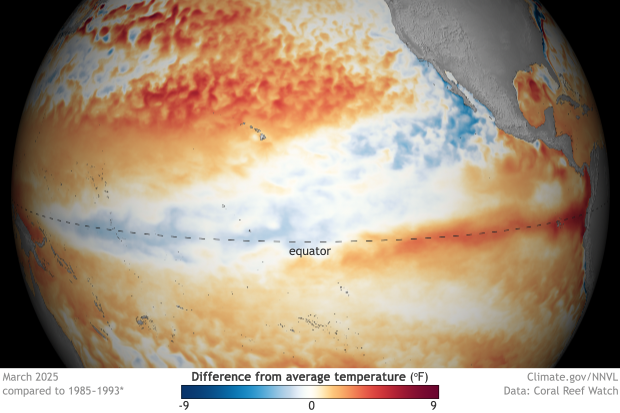
Deep beneath the tropical Pacific, temperatures in some areas have risen more than 8°C above normal, while the World Meteorological Organization now puts the probability that El Niño will persist through February 2027 at nearly 100 percent.
What happens next will not be confined to weather.
Agriculture, energy production, food prices, water security, global supply chains and, ultimately, economic and political stability all enter the equation.
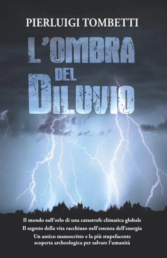
If you want a glimpse of what the world could look like if events take a dramatic turn, I recommend my novel L’OMBRA DEL DILUVIO (THE SHADOW OF THE FLOOD):
https://amzn.eu/d/0c8lGcPQ
Following the adventure of IL SETTIMO SEPOLCRO (THE SEVENTH TOMB), Enigma University returns — an extraordinary secret research institute dedicated to investigating some of humanity’s greatest unsolved mysteries — in a gripping, high-stakes thriller inspired by historical events and real-world phenomena.Earth, in the aftermath of the COVID-19 pandemic.
Unprecedented climate upheavals begin striking every continent at once. Devastating earthquakes, catastrophic floods, massive hurricanes, and tsunamis of previously unimaginable intensity unleash destruction on an enormous scale.
What initially appears to be a series of unrelated natural disasters may be something far more disturbing…
THE TROPICAL PACIFIC HAS ENTERED AN EXCEPTIONAL CLIMATE PHASE
El Niño is firmly established and continuing to strengthen.
The latest assessment from the World Meteorological Organization (WMO), released on September 3, 2026, describes an ocean-atmosphere system displaying unusually strong and consistent signals.
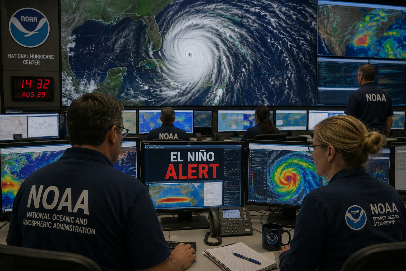
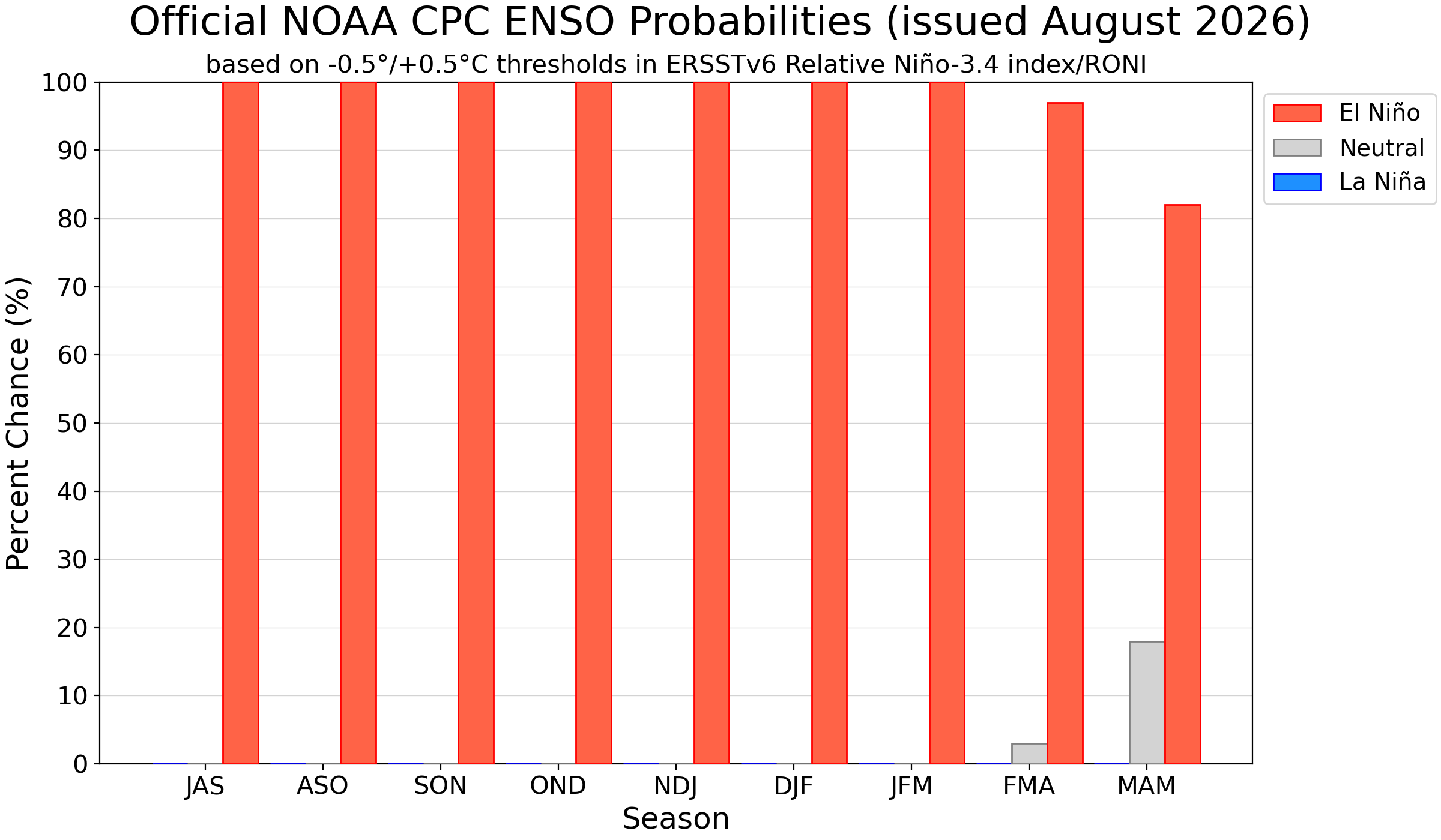
The probability that El Niño will persist through fall 2026 and the Northern Hemisphere winter, extending into February 2027, is now close to 100 percent — the highest degree of confidence the WMO has ever expressed in one of its El Niño/La Niña Updates.
The question, in other words, is no longer whether El Niño will develop.
It is here. It is strong. And it is getting stronger.
What remains uncertain is just how powerful it will become.
According to the WMO, the event is expected to reach “very strong” intensity before peaking toward the end of 2026. If the current trajectory continues, the organization considers it possible that this El Niño could surpass any event observed since modern WMO monitoring began.
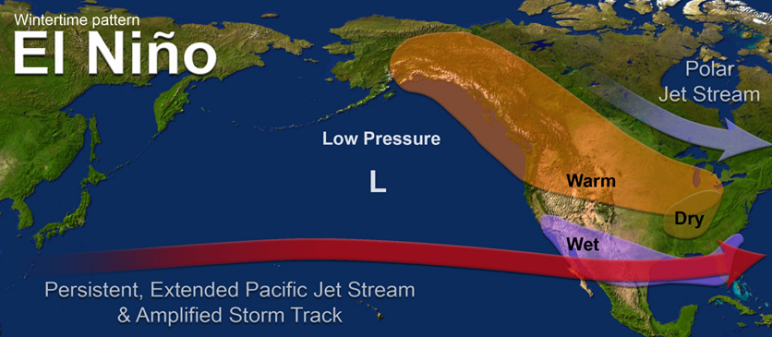
El Niño jet-stream pattern over the United States. Source: NOAA.
WHAT IS HAPPENING BENEATH THE PACIFIC
One of the most revealing signals is not at the ocean’s surface.
It lies beneath it.
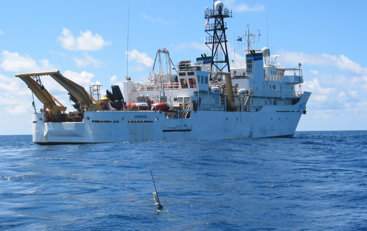
During July and early August, subsurface temperature anomalies exceeding +8°C above normal were observed in parts of the tropical Pacific. This is an exceptionally important indicator.
That vast body of unusually warm water acts as an enormous reservoir of energy capable of feeding the evolution of El Niño. At the same time, sea-surface temperatures across the central and eastern equatorial Pacific remain well above average.
El Niño, however, is not simply a matter of “a warmer Pacific.”
It is the product of a complex interaction between ocean and atmosphere known as ENSO — the El Niño–Southern Oscillation.
Under normal conditions, equatorial trade winds blow from east to west, helping to push and accumulate warm surface water in the western Pacific. Along the coast of South America, those winds also help drive the upwelling of colder, nutrient-rich water from the depths.
During El Niño, that balance changes.
The trade winds weaken. Warm water spreads eastward across the central and eastern Pacific. The upwelling of cold, nutrient-rich deep water is reduced. Atmospheric pressure patterns shift, tropical convection reorganizes and the major zones of rainfall begin to move.
The result is a reconfiguration of atmospheric circulation capable of transmitting effects thousands of miles beyond the Pacific itself.
THE NUMBER TO WATCH: NIÑO 3.4
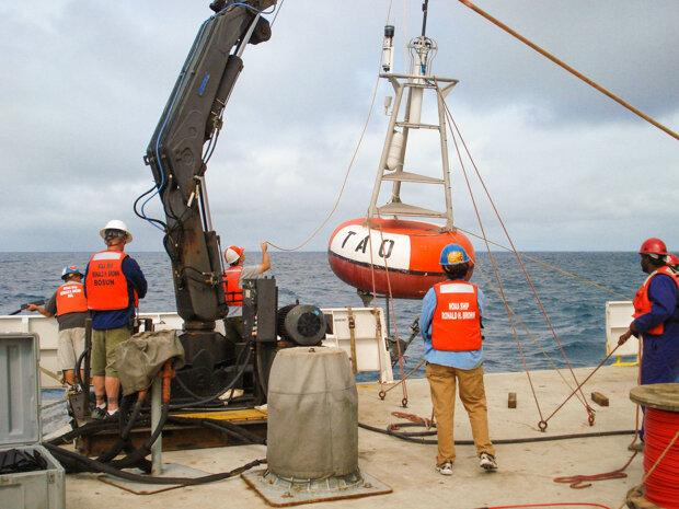
One of the principal indicators scientists use to monitor ENSO is the sea-surface temperature in the region known as Niño 3.4, a vast band of the equatorial Pacific extending roughly from 5°N to 5°S and from 170°W to 120°W.
During the March–May 2026 period, the seasonal Niño 3.4 index had reached approximately +0.5°C, the threshold associated with the onset of El Niño conditions.
But the acceleration was already unmistakable: the index had risen from approximately 0.0°C in March to +0.9°C in May.
Subsequent WMO multi-model simulations pointed to a far more rapid increase, with seasonal values climbing toward +2°C.
That is the range in which El Niño events are generally classified as very strong.
But the most important point is not simply the surface temperature anomaly. The ocean and atmosphere are responding together, making the ENSO signal considerably more robust.
THERE IS NO SINGLE “EL NIÑO CLIMATE”
One of the most common misconceptions about El Niño is that it simply makes the entire planet warmer.
The reality is considerably more complex.
By redistributing energy across the Pacific, El Niño can alter large-scale atmospheric waves, shift jet streams, displace rainfall belts and reorganize systems of high and low pressure.
One region may experience exceptional rainfall while another, thousands of miles away, moves toward drought.
WMO seasonal projections for September through November 2026 show an increased probability of above-normal temperatures across nearly all of the world’s major land areas, accompanied by significant changes in precipitation patterns.
A very strong El Niño increases the risk of drought, flooding, extreme rainfall and heat waves.
But the severity of those effects varies enormously from one region to another.
That distinction matters: an exceptionally powerful El Niño does not automatically mean exceptionally severe weather in every country.
ANOTHER OCEANIC SIGNAL IS EMERGING
The Pacific is not the only ocean basin displaying an important signal.
The WMO is also forecasting the development of a positive Indian Ocean Dipole (IOD), with a seasonal average of approximately +0.9°C projected for September, October and November 2026.
The Indian Ocean Dipole measures the temperature contrast between the western and eastern regions of the Indian Ocean.
During its positive phase, waters in the western Indian Ocean tend to become relatively warmer than those in the east, significantly altering regional rainfall patterns.
The simultaneous presence of a powerful El Niño and a positive IOD therefore creates an unusually complex climate configuration across East Africa, the Indian Ocean, South Asia, Indonesia and Australia.
Adding another layer to the picture, the tropical Atlantic also remains generally warm.
What scientists are observing, then, is not a single isolated anomaly. Several of the world’s major ocean basins are simultaneously exhibiting thermal conditions capable of influencing global atmospheric circulation.
WHEN CLIMATE BECOMES GEOPOLITICS

This is where the story stops being purely meteorological.
The effects of El Niño can move through the global economy along a relatively straightforward chain:
climate → harvests → commodity availability → prices → inflation → social and political stability.
Drought and extreme rainfall can affect the production of grains, sugar, coffee, cocoa, rice, vegetable oils and numerous other agricultural commodities.
Changes in rainfall can also alter the amount of water available for irrigation and hydroelectric power generation.
The consequences become particularly serious in countries that depend heavily on imported food or energy and have limited foreign-currency reserves.
A simultaneous rise in food and energy prices can quickly feed into domestic inflation, government budgets and the cost of public subsidies.
And when those pressures hit countries already facing political or economic instability, a climate disruption can evolve into a national-security problem.
ENERGY, WATER AND GLOBAL SUPPLY CHAINS
There is another dimension that receives far less attention.
Reduced rainfall across major hydroelectric basins can cut electricity production precisely when high temperatures are driving demand upward.
Governments may then be forced to increase generation from other sources or import additional energy.
At the opposite extreme, exceptional rainfall can damage roads, railways, ports and other critical infrastructure.
The question, therefore, is not simply how much food the world will produce.
It is also whether the vast networks that transport food, raw materials and energy will continue to function normally.
In the deeply interconnected global economy of 2026, a regional climate event can rapidly become an international economic problem.
EL NIÑO AND GLOBAL WARMING ARE NOT THE SAME PHENOMENON
El Niño is a naturally occurring oscillation of Earth’s climate system. It existed long before modern industrial society and forms part of recurring natural variability.
During a strong El Niño, enormous quantities of heat stored in the tropical ocean are transferred toward the atmosphere.
When that process occurs against a background of already elevated oceanic and atmospheric temperatures, it can contribute to new global temperature extremes.
The major El Niño of 2023–2024, for example, contributed to the exceptional temperatures recorded in 2024.
That is one reason the WMO is watching developments between late 2026 and 2027 so closely.
WHAT WE KNOW
As of September 3, 2026, several elements are no longer hypothetical.
El Niño is fully developed.
It is continuing to intensify.
Sea-surface temperatures across the tropical Pacific are exceptionally high, while subsurface temperature anomalies have exceeded 8°C above normal in some areas.
The probability that El Niño will persist through February 2027 is close to 100 percent.
The WMO expects it to reach “very strong” intensity before peaking toward the end of 2026.
What remains unknown is its ultimate ceiling.
The possibility that this could become the strongest El Niño of the modern monitoring era is real. It is not, however, an established fact.
And that may be the most important distinction of all.
We are no longer waiting to see whether El Niño will arrive.
It has arrived.
The question now is how far it will go — and which parts of the world’s climatic, economic and geopolitical systems will feel its effects most acutely.
WHAT COULD 2027 LOOK LIKE?
🌡️ 1. AN EXCEPTIONALLY WARM YEAR GLOBALLY
This may be the most consequential signal.
The effect of El Niño on global average temperature often becomes more pronounced after the Pacific itself reaches peak warming. The WMO has specifically noted that the temperature impact can be strongest in the year following the development of an El Niño event.
That places 2027 in a position to become one of the warmest years ever observed. Reuters has reported that the possibility of another global temperature record is also being considered.
🌧️ 2. GREATER RISK OF EXTREME RAINFALL AND FLOODING
A very strong El Niño alters the position of major tropical convection zones and can influence the jet streams.
During the opening months of 2027, that translates into a greater probability of anomalous rainfall across parts of the southern United States, southern South America and East Africa, although the precise distribution will also depend on other major oceanic and atmospheric oscillations.
The WMO has explicitly warned of increased flood risks associated with the event.
☀️ 3. GREATER DROUGHT RISK ELSEWHERE
The opposite side of the equation affects parts of South and Southeast Asia, Indonesia, Australia and Central America, where the teleconnections typically associated with El Niño can favor rainfall deficits.
That does not mean this entire vast region will experience drought.
It does mean that the probability of regional water shortages and agricultural stress increases.
🔥 4. EXTREME HEAT AND WILDFIRE RISK
Already-high background temperatures combined with the influence of El Niño increase the probability of further temperature extremes.
Where intense heat coincides with rainfall deficits, vegetation can dry rapidly and wildfire risk rises.
The WMO is already forecasting above-normal temperatures across almost all continental land areas for September through November 2026, and part of the thermal influence of this El Niño is expected to continue into 2027.
🌾 5. AGRICULTURE AND FOOD PRICES COULD BECOME A MAJOR STORY
This is where El Niño becomes an economic and geopolitical issue.
Simultaneous changes in rainfall patterns can affect crops including corn, rice, sugar and coffee, as well as other tropical and subtropical agricultural products.
The scale of any losses in 2027 cannot yet be predicted reliably, but the WMO is already emphasizing preparedness in agriculture, water management and energy precisely because of these risks.
🐠 6. MARINE ECOSYSTEMS IN THE PACIFIC WILL COME UNDER PRESSURE
Exceptionally warm water alters biological productivity, nutrient availability and the geographical distribution of marine species.
El Niño typically suppresses the upwelling of cold, nutrient-rich water in the eastern Pacific, potentially disrupting fisheries and marine food webs.
These effects can persist even after El Niño itself begins to weaken.
WHAT ABOUT ITALY AND THE MEDITERRANEAN?
Here, greater caution is necessary.
The connection between El Niño and European weather is considerably less direct and predictable than it is across the Pacific, the Americas and parts of Africa and Asia.
It would therefore be scientifically unjustified to claim today, for example, that “Italy will experience a drought-stricken summer in 2027 because of El Niño.”
Any influence on Europe may be transmitted through changes in atmospheric circulation over the North Atlantic, but the outcome also depends on the North Atlantic Oscillation (NAO), Atlantic and Mediterranean conditions, stratospheric dynamics and numerous other factors.
For Italy, the most robust implication is therefore indirect: an exceptionally warm 2027 globally would provide a background environment more favorable to temperature extremes, but it does not yet allow scientists to predict the specific character of the Italian spring or summer.
What is clear is that the extraordinary accumulation of heat in the Pacific represents an immense injection of energy into the coupled ocean-atmosphere system.
That energy is capable of altering weather patterns on a planetary scale and increasing the conditions under which unusually powerful climate extremes can develop.
Over the coming months, observations will reveal how closely reality follows the models — and just how far the consequences of this El Niño will reach.
SOURCES AND FURTHER READING
World Meteorological Organization (WMO) — El Niño Set to Become Very Strong, Raising Risks of Extreme Weather Into 2027, September 3, 2026.
World Meteorological Organization (WMO) — El Niño/La Niña Update, August 2026, published September 3, 2026.
World Meteorological Organization (WMO) — Global Seasonal Climate Update, September 2026.
NOAA Climate Prediction Center — ENSO Diagnostic Discussion, 2026 updates.
WMO Lead Centre for Long-Range Forecast Multi-Model Ensemble — Global seasonal ENSO, temperature and precipitation anomaly forecasts.
